Sonar, Robots Help Salvage Ancient ShipwrecksSonar, Robots Help Salvage Ancient Shipwrecks
Odyssey Marine Exploration uses the latest sonar technology and robotic divers to unearth historic vessels from the ocean floor.

7 Ways To Create E-Portfolios
7 Ways To Create E-Portfolios(click image for larger view)
Approximately 3 million shipwrecks litter the ocean floor, according to the United Nations. Hundreds already have been discovered by Odyssey Marine Exploration. The team of researchers, scientists, technicians and archaeologists is dedicated to discovering shipwrecks and bringing their stories to the surface.
"It's like working in the world's largest museum," Ellen Gurth, archaeological curator for Odyssey Marine Exploration, of the company's missions, said in an interview. In Odyssey's traveling exhibit, currently located in New York's Times Square, visitors can view over 500 shipwreck artifacts, operate a robotic "arm" to pick up coins, or zoom in on a "photomosaic" of a wreck site.
Odyssey currently is 300 miles off the coast of Ireland, excavating the SS Gairsoppa. The steel-hulled British cargo steamship sank on Feb. 17, 1941 after being attacked by a German U-Boat. So far, 48 tons of silver have been uncovered from the wreck, which is submerged at 15,000 feet below sea level.
Excavations like these are possible only with cutting-edge technology. Mark Gordon, president and chief operational officer for Odyssey Marine Exploration, described how modern technological innovations have been crucial to Odyssey's success. "It has been an evolutionary process. We take bits and pieces [of new technology] and adapt them to our specific needs," Gordon said.
[ Looking for a way to give students practical programming experience? Loyola Students Code For Campus App Store.]
The advances in sonar software, which the team uses to find shipwrecks, has proven invaluable. After determining a 300-square-mile estimate of a shipwreck's location, the team sets out on the Odyssey Explorer recovery vessel to do a preliminary search using side-scanning sonar technology. The sonar is encased in a metal body, called the towfish, which is attached to the Explorer by cable and hovers 60-200 feet over the seabed.
As the towfish moves, the sonar emits "pings" that echo back when an object is detected. The echo data is transmitted to the surface, where a technician monitors the sonogram images. "The improvement of sonar allows us to get better images at higher rates and speed," explained Gordon. With previous technology, technicians had to examine every sonar target that could possibly be significant. With the most recent software, artificial intelligence determines which objects are of interest, speeding up the broad-scanning process.

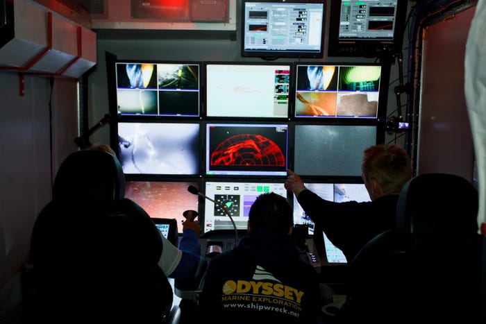
Piloting the robot
Piloting the robotic explorer.
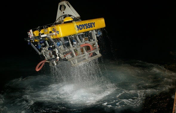
Once the wreck is found, it is inspected with a high-resolution sonar pass. If the ship is still not deemed worthy of inspection, the team can deploy a remotely-operated vehicle (ROV), a small robot that explores with cameras and lighting in deep water to give a better view. If the site is ready for excavation then a working-class ROV is deployed. Odyssey uses two working-class ROVs, Zeus and Zeus 2, to physically inspect wrecks and obtain artifacts. Both use limpet suction devices on their "arms" to recover items ranging from porcelain figurines to 600-pound objects. Yet there is one more big step before excavation can begin. "Before we disturb the site or touch anything, we have to have a record that shows the site as it was," Gordon said.
Thousands of high-resolution photographs are taken and stitched together to form a singular image called a photomosaic, or pre-disturbance survey. To record the GPS coordinates of the photomosaic, the team places acoustic transponders on the wreck site and seabed. Measurements are taken acoustically by bouncing sound waves between the wreck, transponders and datum points.
Once the photomosaic is created, the ROV physically inspects the wreck and recovers artifacts. GPS coordinates -- latitude, longitude and depth -- of each artifact are recorded while also accounting for tidal flow. The team can then geospatially recreate the wreck site with accuracy and show where objects were found in relation to the photomosaic.
The ROV is operated by technicians on board the Explorer who rely on high-definition cameras, digital still cameras and HMI lighting to navigate the wreck. During the excavation, the ROV sends digital data to the Explorer, where it is interpreted as positioning data. The inertial navigation system in the ROV is constantly updated, leading to a two-way stream of data between the Explorer and the ROV. Odyssey's DataLog program records all GPS data in real time so that the team knows where they are working, and exactly where each artifact comes from, within a few centimeters' accuracy. Using satellite broadband technology, the team transmits large data feeds back to the mainland.
This technology is sufficient to uncover most of the wrecks that Odyssey has discovered; however, the SS Gairsoppa is an exception. Because of the wreck's depth, Odyssey chartered the deep-sea Seabed Worker, which contains steel-cutting capabilities and working-class ROVs rated to work at such depths.
"Really, the hardware are just tools," said Gordon about the ease of swapping vehicles. "The methodology we use and the expertise to manage projects, those are unique to Odyssey."

Zeus
The Zeus remotely operated vehicle returns to the surface.
Since its founding, Odyssey has mapped over 17,000 square miles of seabed. Ten thousand hours have been spent using advanced robotic technology to explore shipwrecks that date from 1622 through the 20th century.
About the Author
You May Also Like


